Aerial Drone Footage
Efficient aerial inspections
Drone Inspections (Aerial Surveys)
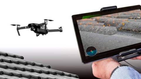
Drone inspections provide a safe, efficient and non-invasive method of inspecting areas of a property that are difficult, unsafe or impractical to access during a conventional inspection. High-resolution aerial imagery allows critical external elements to be viewed in detail without the need for scaffolding, ladders or roof access.
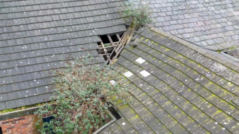
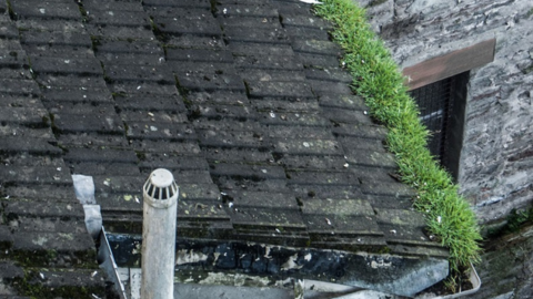
This technology is particularly effective for assessing roofs, chimney stacks, parapet walls, valleys, gutters and other high-level components. Common defects such as slipped or broken tiles, deteriorated flashings, eroded mortar joints, blocked rainwater goods and storm-related damage can be identified and visually recorded.
All drone imagery is reviewed and interpreted by a qualified residential surveyor and used to support professional judgement. Images are included where relevant to provide clear visual evidence and improve client understanding of the condition and performance of the property.
Findings are always considered alongside ground-level observations, internal inspection results and the wider context of the building.
When Is a Drone Inspection Used?
A drone inspection may be employed where roof access is restricted due to height, pitch, fragility of coverings or health and safety considerations. It is also appropriate for larger or multi-storey properties, buildings with complex roof layouts, or where neighbouring structures limit access.
This method is particularly useful when early signs of deterioration are suspected but cannot be confirmed from ground level alone. It allows targeted investigation and helps determine whether further specialist inspection or repair is required.
Using drone technology, we can inspect areas of the property that are difficult or unsafe to access from ground level. High-resolution aerial images provide a clear overview of roof coverings, chimney stacks, elevations, and hard-to-reach junctions, helping us identify defects and maintenance issues with far greater accuracy.
Integration with RICS Level 3 Building Surveys
Within a RICS Level 3 Building Survey, drone inspections are used as an enhanced inspection technique to improve coverage of high-level elements. The information gathered supports condition assessment, risk analysis and repair advice in line with RICS guidance.
Drone imagery helps reduce limitations typically associated with inaccessible areas and strengthens the reliability of the survey findings. Where defects are identified, clear recommendations are provided, including advice on urgency, further investigation and likely remedial action.
Drone Inspection – Service Overview
Drone inspections allow high-level external elements such as roofs and chimneys to be inspected safely and efficiently using high-resolution aerial imagery. Drone Inspection enhance the overall survey process but do not replace physical inspection where safe access is available.